Daytona Beach, FL - A low-pressure system that's making its way down from the eastern Florida Panhandle towards the Gulf of Mexico has been on the minds of some people lately.
Some residents have been concerned with the possibility of the system getting enough fuel over the Gulf to become Florida's first named storm of the season - which if it were to form, it would be named Barry.
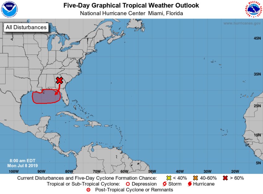
"Right now we have a broad low-pressure system that's located over the eastern Florida Panhandle, and the shower activity associated with it is pretty disorganized," said Dennis Feltgen, public affairs officer and meteorologist with the National Hurricane Center. "That low is forecast to move south to southwest and emerge over the Gulf of Mexico."
Once over the Gulf of Mexico, Feltgen said that the system does have the possibility of becoming a tropical disturbance, with the chance of forming a tropical depression.
But, once it's over the gulf it's expected to move westward and away from the state.
That may sound like it won't bring any impact to the eastern coast, but you can expect a little more rain later in the week.
Feltgen said the east coast, which includes the Daytona Beach area, will see an enhanced risk of rain due to how unstable the atmosphere will be and because of the wind flow out of the southwest.
Some residents are also concerned over Floridians in the Panhandle, as some are still recovering from Hurricane Michael. Feltgen said that the Panhandle will see a lot of rainfall, but they're not sure where the heaviest rain will fall.
Although some predictions show that Louisiana and eastern Texas will see the heaviest rainfall from this system as it develops.
Right now, the system is expected to make it to the Gulf today (July 9th) before it develops sometime later this week.


