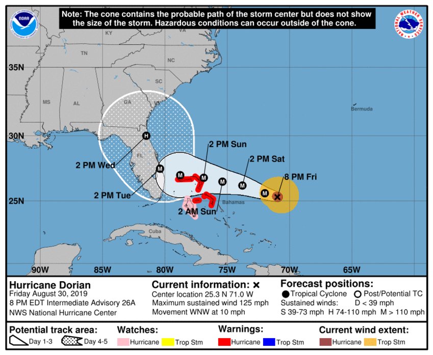
Daytona Beach, FL - Hurricane Dorian is picking up speed slightly, but it's also picking up strength as it begins to move towards the west.
The National Hurricane Center says Dorian, which has now been classified as a Category 4, is moving toward the west-northwest near 10 mph. A slower west-northwestward to westward motion should begin tonight and continue into early next week.
Data from a NOAA Hurricane Hunter aircraft indicate that the maximum sustained winds have increased to near 130 mph with higher gusts. Hurricane-force winds extend outward up to 30 miles from the center and tropical-storm-force winds extend outward up to 115 miles.
Models are still predicting that Dorian will continue to the west-northwest where the storm will move over the northwest Bahamas as it nears the Florida peninsula.
Originally, some forecast models were predicting that once Dorian neared the Florida east coast, it would move inland before turning towards the north, essentially up the middle of the state.
But, new models predict that Dorian could follow a path similar to Hurricane Matthew's path, which could take the storm up the east coast instead of going completely inland.
News Daytona Beach will monitor the tropics and provide updates as soon as possible when they’re available.
Text STORM to 51879 for the latest reports regarding Hurricane Dorian.
You can download the free WNDB app for your Apple or Android device for updates regarding severe weather and tropical storms.
Listen live for updates on FM 93.5, AM 1150, WNDB and through our livesteam.


