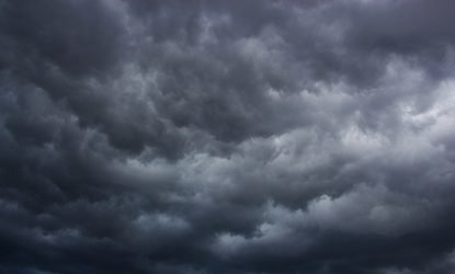
Daytona Beach, FL - A line of storms will bring some cold air, high winds and possible isolated tornadoes according to the National Weather Service.
NWS Melbourne says a potent storm system developing near the Gulf Coast is expected to make its way across the state of Florida and into the Volusia/Flagler County Area.
Tony Cristaldi, a meteorologist with NWS Melbourne, says the greatest threat for storms in Volusia will be between 4 p.m. and 8 p.m. today.
"Some of these storms could be strong to severe," Cristaldi said. "We're looking at some potential for wind gusts in excess of 50 mph."
Cristaldi said an isolated threat for tornadoes is also possible for the Volusia County area.
Another report Cristaldi gave to WNDB shows that the storms are also expected to drag a cold front along with it.
He said that the high for today is set to hang around the low 80's to the high 70's, with the high dropping to the low 70's and upper 60's for tomorrow morning.


