Volusia County, FL - Update: The National Weather Service in Melbourne has issued a comprehensive post-storm report on Hurricane Matthew.
To see the post-storm report, go to
Forecast.Weather.Gov.
Earlier Reporting:
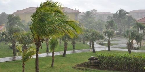
The National Weather Service in Melbourne has put together a comprehensive list of data on the highest sustained winds, wind gusts and rainfall measured during Hurricane Matthew.
The winds observed include a spotter observation at 8 AM on Friday at Haulover Canal of a sustained wind of 75 MPH with a gust to 102 MPH. Just before 9 AM, a spotter at the same site at Haulover Canal measured a wind gust of 107 MPH. Then at 10:12 AM on Friday, Daytona Beach International Airport clocked a wind gust of 91 MPH. DBIA also measured 5.29 inches of rainfall during the storm.
The NWS Melbourne data on wind and rain is
here.
"We are going to issue a comprehensive report, called a Post Storm Report," said John Pendergrast NWS Melbourne Meteorologist. "Which will have everything in there from the lowest pressures recorded, to the most rainfall, wind speeds and damage information. And we're going to have that in one report as soon as we finish assessing the area."
2016 Southern Stone Communications Copyright


