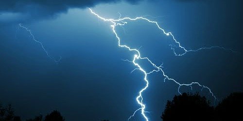
 Flagler & Volusia County, FL - State and local emergency officials are warning residents and visitors about the severe weather that will continue throughout North Florida and Central Florida, today and tonight.
This weather will have the potential to produce large hail, damaging wind gusts and tornadoes.
Governor Scott said, "It is incredibly important that Floridians and visitors in North Florida pay close attention to local news throughout the day and ensure they are fully prepared ahead of any potentially damaging weather, such as tornadoes or flash floods. While we are glad that the weather from earlier this week did not cause significant damage, we must take every case of potentially severe weather seriously and take action to keep our families and communities safe."
Tornado watches may be issued throughout the day. Residents and visitors to the state should monitor local media outlets and ensure that their NOAA All Hazards Weather Radio alert settings are turned on.
"Much of North Florida and parts of Central Florida have been placed at high risk of severe weather throughout the day and overnight", said State Meteorologist Amy Godsey.
With the severe weather outlook for today, Palm Coast is at a marginal risk while Jacksonville Beach and St. Augustine are at a slight risk.
Flagler & Volusia County, FL - State and local emergency officials are warning residents and visitors about the severe weather that will continue throughout North Florida and Central Florida, today and tonight.
This weather will have the potential to produce large hail, damaging wind gusts and tornadoes.
Governor Scott said, "It is incredibly important that Floridians and visitors in North Florida pay close attention to local news throughout the day and ensure they are fully prepared ahead of any potentially damaging weather, such as tornadoes or flash floods. While we are glad that the weather from earlier this week did not cause significant damage, we must take every case of potentially severe weather seriously and take action to keep our families and communities safe."
Tornado watches may be issued throughout the day. Residents and visitors to the state should monitor local media outlets and ensure that their NOAA All Hazards Weather Radio alert settings are turned on.
"Much of North Florida and parts of Central Florida have been placed at high risk of severe weather throughout the day and overnight", said State Meteorologist Amy Godsey.
With the severe weather outlook for today, Palm Coast is at a marginal risk while Jacksonville Beach and St. Augustine are at a slight risk.

(Image Courtesy NWS Jacksonville)

(Image Courtesy NWS Melbourne)
According to the National Weather Service, both Flagler and Volusia County will also be experiencing record tying heat today with temperatures rising as high as 91 degrees. Daytona Beach has the highest possibility of breaking a record high this afternoon. The current daily record high for April 5th in Daytona Beach was 90 degrees in 1957.
(Image courtesy NWS Melbourne)
For more information about the Florida Division of Emergency Management, visit Floridadisaster.org.Copyright Southern Stone Communications 2017.